
 Galatas, apart from the beautiful scenery, is not much interesting, but it is a great base to visit the archaeological site of Troezen, the “Devil’s Bridge” over the river gorge Gefiraion and take a walk through the streets of Poros, a characteristic island in the Saronic Gulf which is only 300 meters from the mainland.
[sam id=”7″]
Galatas
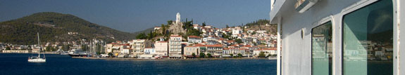
 View of Poros from Galatas, the strip of sea that divides them is only 300 meters
We are 93 km south of Corinth and 47 kilometers south-east of the theater of Epidaurus. You can say Galatàs to be the little sister of the City of Poros, smaller and far less interesting. However, it offers a good base for water supply, overnight stop and the opportunity to visit a few nearby attractions. And speaking of attractions, all guides mentions the Lemonodasos (lemon wood) as something interesting … for me the only reason to go is the convenient public tap, perfect for refilling the water tank, which is located on the wall of the church at the junction between the main road and the road to Lemonodasos, 3 km and a half south of Galatas.
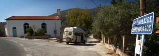 Refilling the water tank at Lemonodasos
One kilometer before reaching Lemonodasos on the left you will find a beach with a small taverna and a parking lot for boats. We found it perfect for the night because it has the advantage of being ventilated and cool even on the warmest nights.
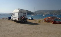 The camper that you see in the picture is not ours, it’s a identical brother, even if younger and more handsome, owned by very nice Spanish couple. In seven years it was the first time that we encountered a twin 🙂
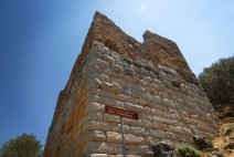
Troezen and the Devil’s Bridge
At 8 km west of Galatas, lies the village of Troezen or Troizin from where can be found the directions to the archaeological remains and the Devil’s Bridge.
A few hundred meters after leaving the village behind you, you will find yourself at a crossroads. On the left you go to the Tower and to the Devil’s bridge, to the right you go to the Acropolis. The road is unpaved, but in relative good condition, with a small camper and a bit of patience you can get to up the open space near the Devil’s Bridge. The worst point is in front of the tower, if you pass through that you are ok, the rest is less demanding.
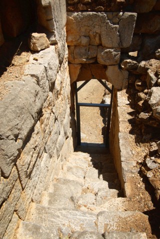
The tower is part of the remains of the ancient city walls and can be visited from inside. Impressive the cyclopic stones that form the base.
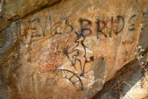
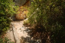
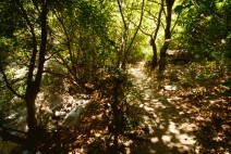
Continuing along the road you arrive at an open space from where starts a short path that leads to the Devil’s Bridge. It is a natural bridge that goes over the river Gefiron in a narrow and impressive gorge. The dense vegetation makes it impossible to clearly see the rock formation that forms the bridge,
but you can get the idea and if you want you can also take a great walk following the path along the gorge … this is definitely not Greece as we are used to see it! Do not forget to bring a suitable footwear, the path is not demanding but a pair of closed shoes are recommended.
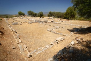
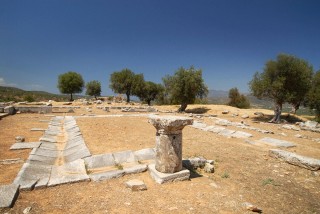
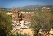
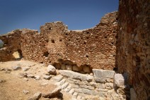
Returning back to the original junction, turn left and after a few hundred meters a sign points the way to the archaeological site. This is also a dirt road, but in very good condition. The space in front of the entrance to the site is sufficient to comfortably maneuver. The site is fenced, however, is open and entry is free. Inside you can see the remains of one of the various sanctuaries of Asklepios scattered throughout Greece and just beyond the unsafe, but definitely suggestive remains of a Byzantine basilica: Panagìa Episcopì.
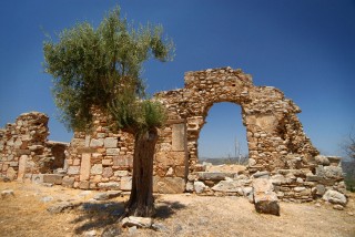
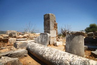
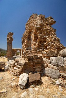
Exterior and interior, so to speak, of the Byzantine basilica, Panagia Episcopi
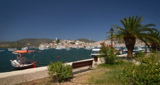
Poros
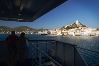
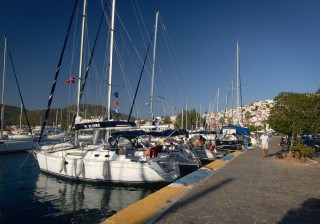
 The island of Poros is really cute. With its neoclassical houses, the relaxed atmosphere. Touristic, but not too much. Loved by the sailing community, it deserves a visit. Especially because from Galatas it takes less than ten minutes by ferry (0.90 € / person + € 5.90 / RV if you want to tour the island) or even faster with “Sea-buses” (1.00 € / person) which leave when they fill up. We preferred to go without the camper. We trusted the guides saying that the rest of the island is nothing special and we left the van in the parking lot of the port, free after 15.00 and holidays, but only for small RVs. Those over 5 meters and a half is better if they park in the open space toward the south exit of the village, signposted as parking for buses and trucks. A curiosity: the island of Poros in ancient times was called Calavria and even now the island’s largest region retains its old name, which means ‘good aurea’. In Calabria (Italy) there is a Mount Poro. Do you think there is a link?
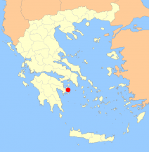
Enlarge Map |
GPS Coordinates
Galatas: Troezen: |
[sam id=”7″]