
 The inland part of Kythira is full of surprises. Probably the most impressive of all are the waterfalls near Milopotamos, but there are also a lot of things to see and to visit. One thing’s for sure: there is something interesting for everyone in Kythira! 🙂
[sam id=”7″]
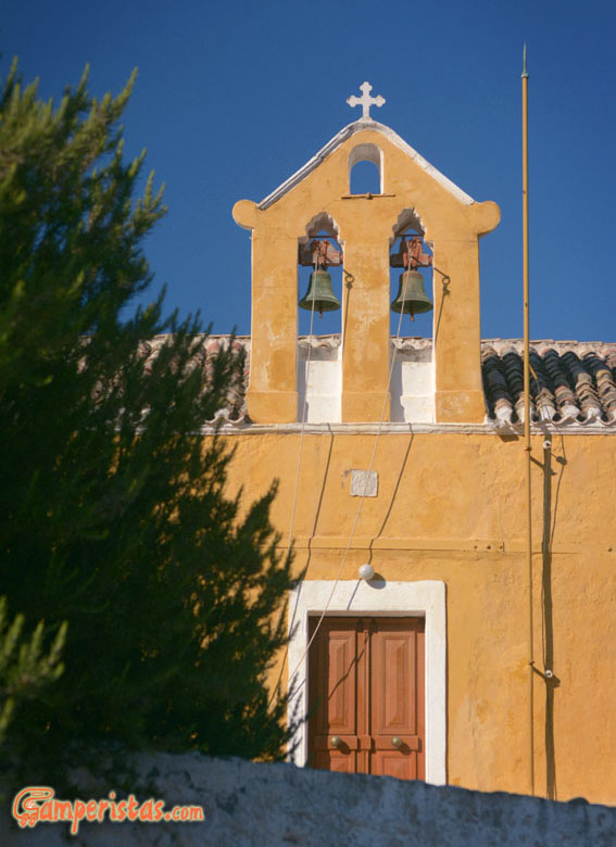
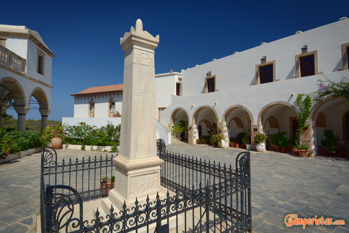
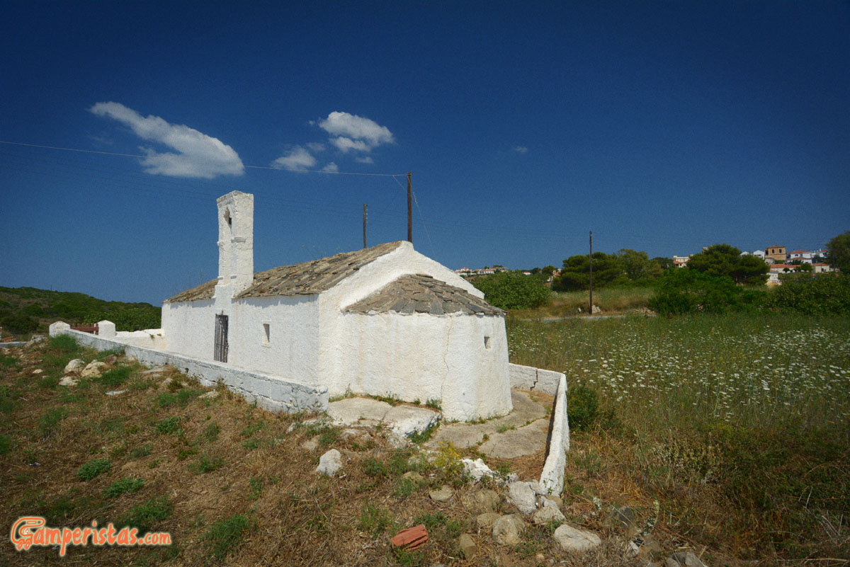
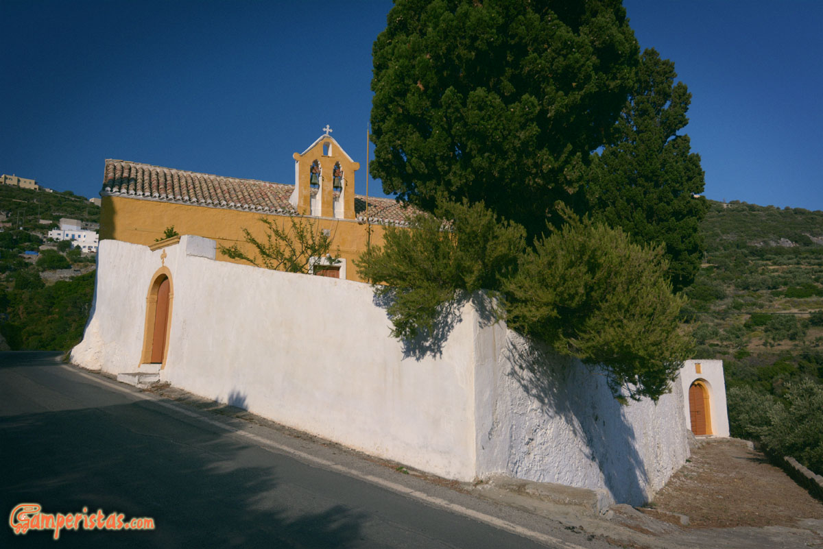 Heading from Chora towards Livadi, we saw this beautiful monastery. We tried to identify its name but it seems that there is a tradition of building small private churches and monasteries and this is just one of the many edifices.

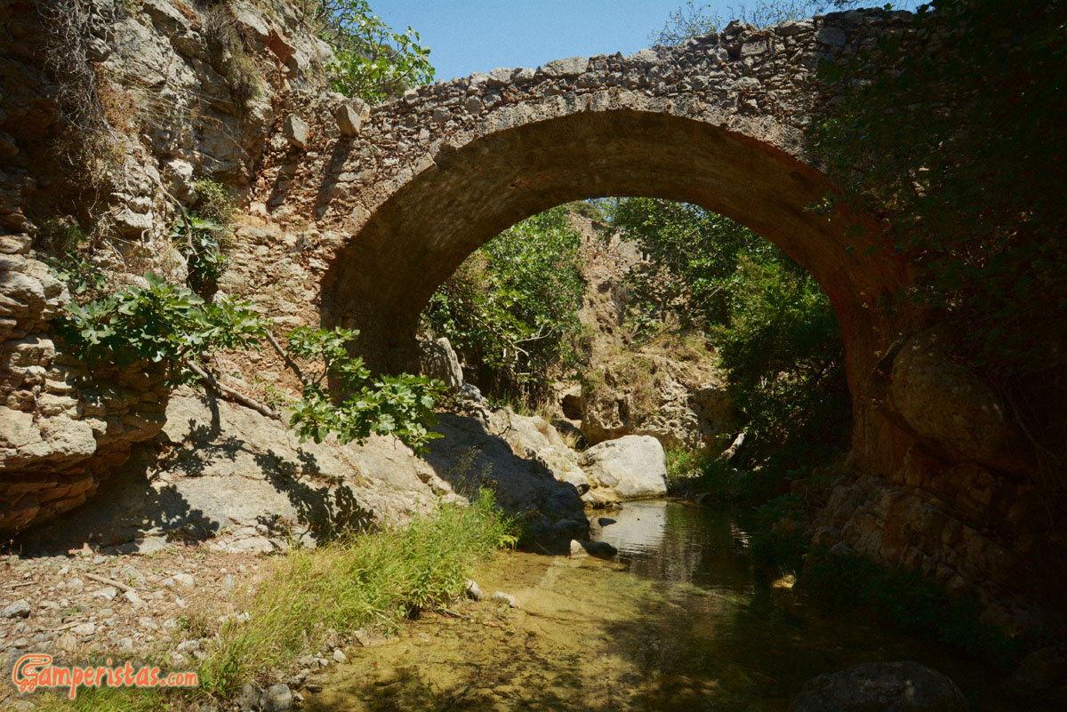
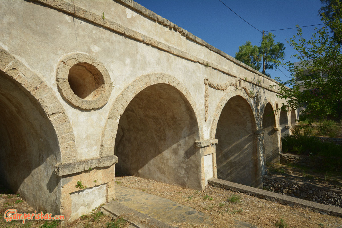
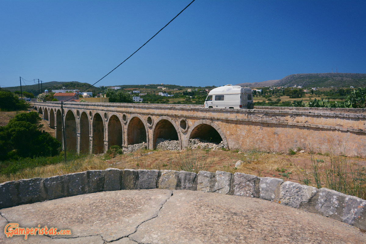 Entering Livadi, we follow the sign for the Katouni bridge (turn right). This impressive 110 meters long bridge is built in stone by the British in the early 1800s.

 At Karvounades, a small town after Livadi towards the north, people still produce charcoal by using traditional earth kilns.
After few kilometers we cross Kalokerines (Summer) a small town that reminds me of Mexico!


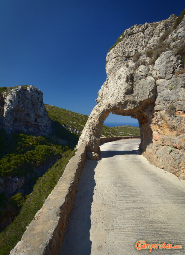
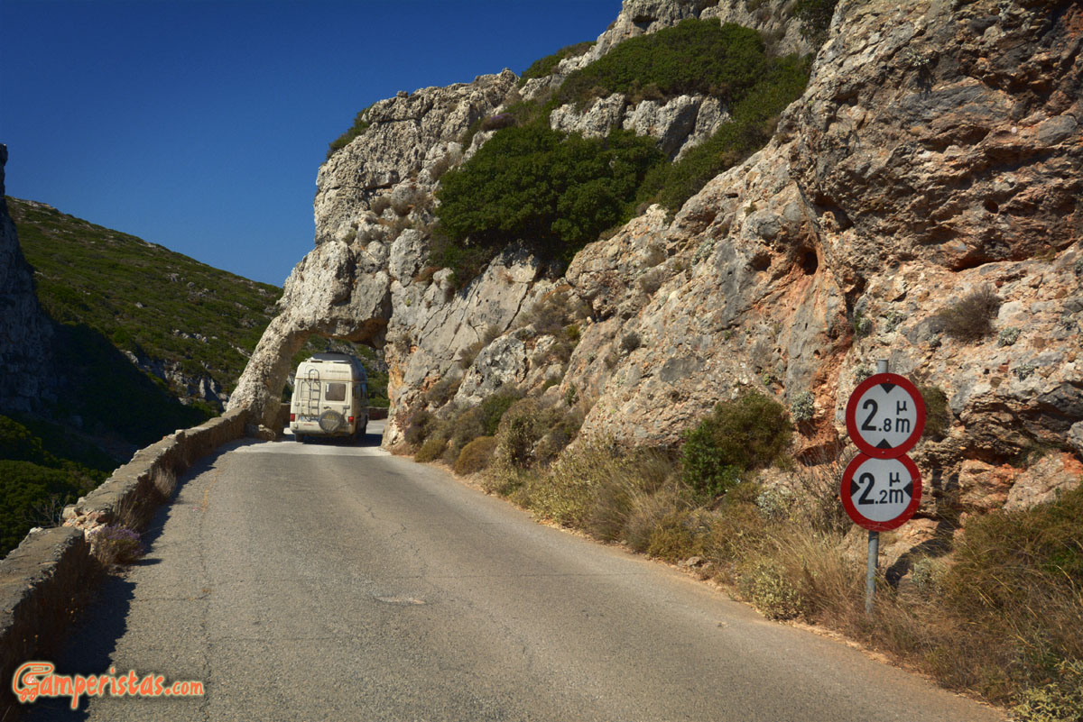
 After Kalokerines, we arrived at this junction, where I stopped by trying to figure out what the sign means. I decided to go left following the first car passing by… After a few tens of meters I found myself watching this spectacular view (here below) !
Fortunately our RV is mini size. If yours is taller than ours (3 meters), I strongly recommend you to take the right detour.
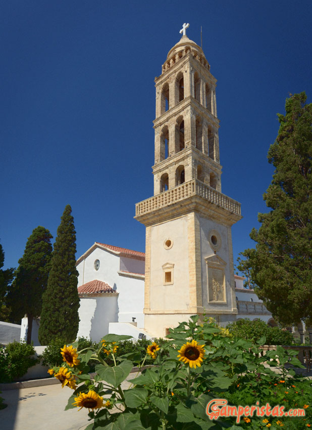
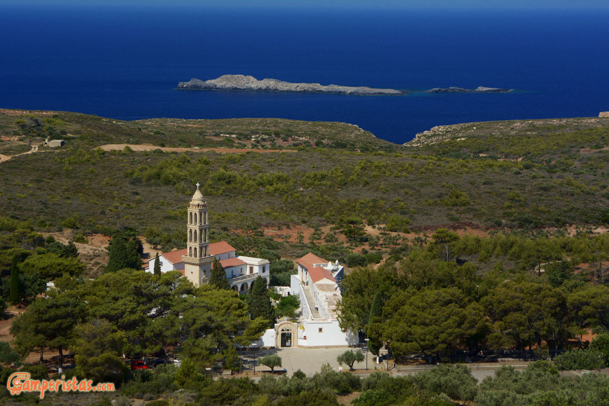
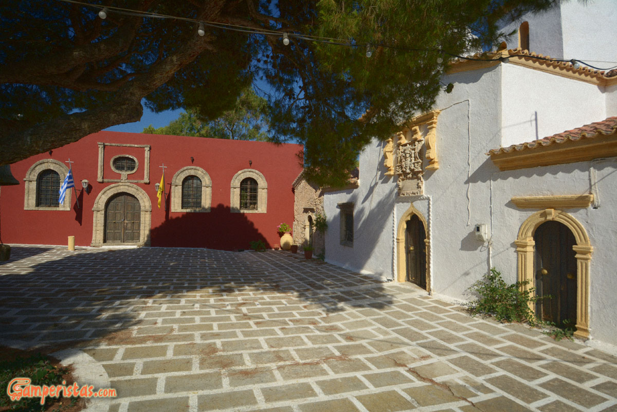
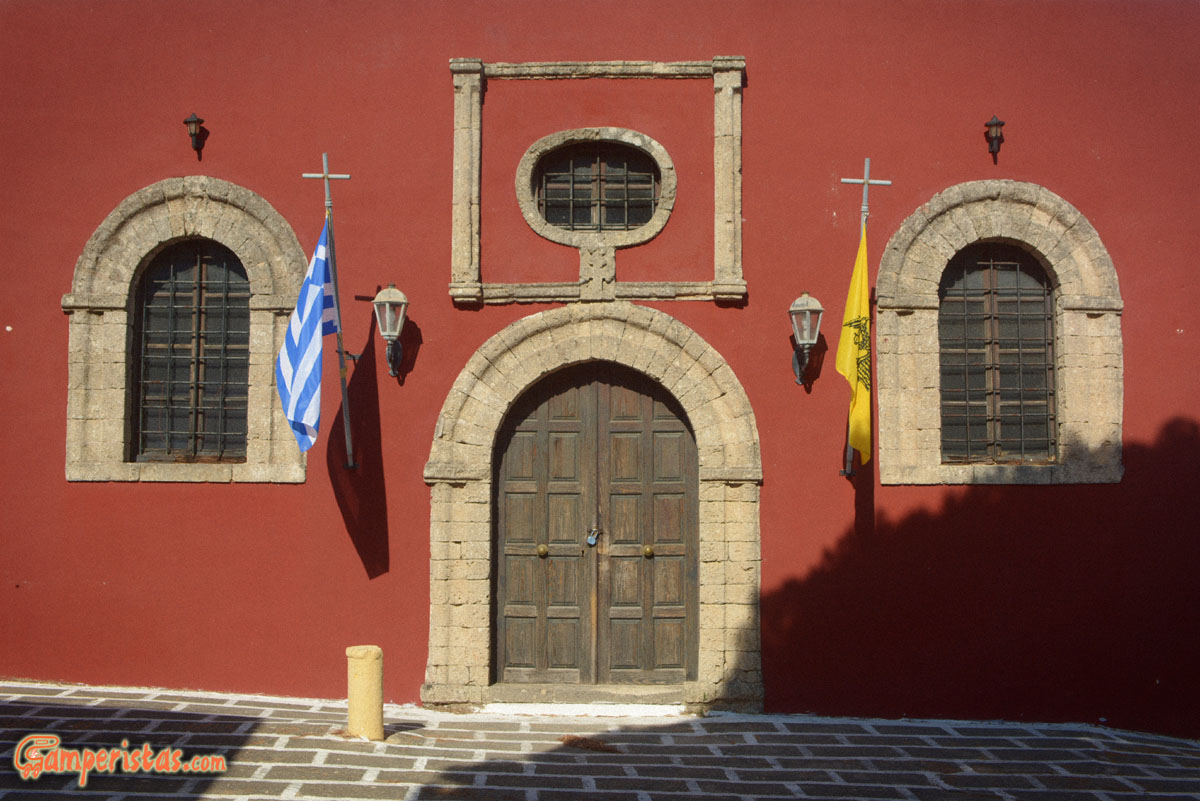
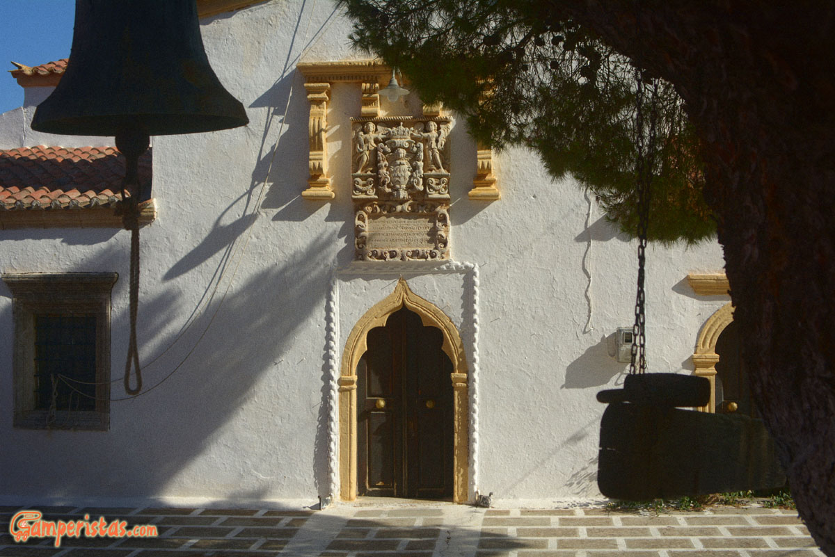
At the end of this road you’ll find the Myrtidion monastery which is located in a beautiful setting. The 19th c. church is nothing special; much more interesting is the old underground church with votive offerings. We asked the priest if we could visit it and they opened it for us but they didn’t let me take pictures 🙁

 Back on the main road heading towards north, we pass by Dokana (right); not worth mentioning, if not for the curiosity of the name that comes from the Italian word for customs (dogana). During the venetian occupation, Dokana was the border crossing point between northern and southern island!
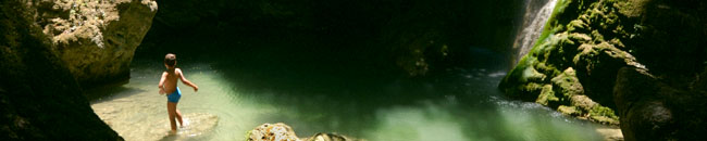
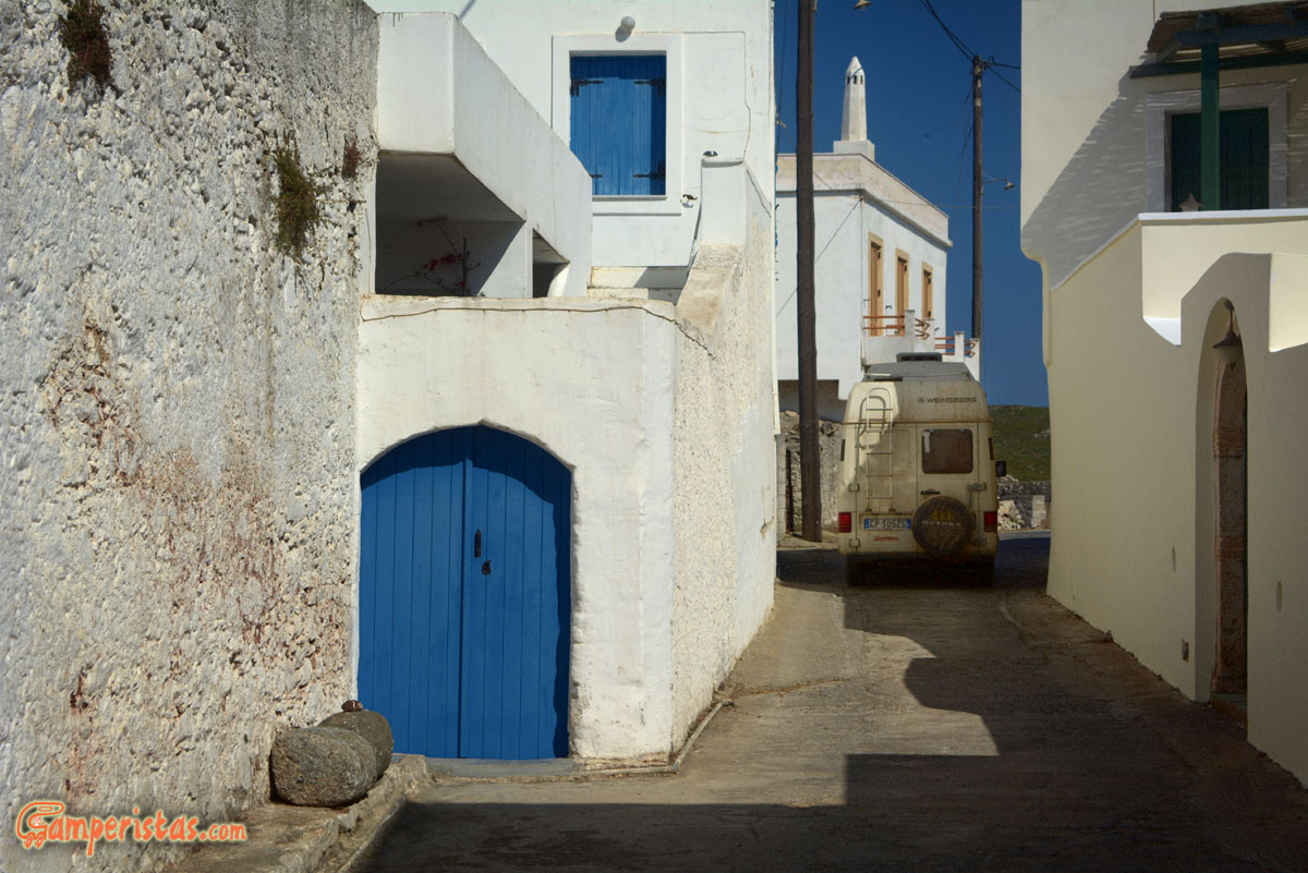
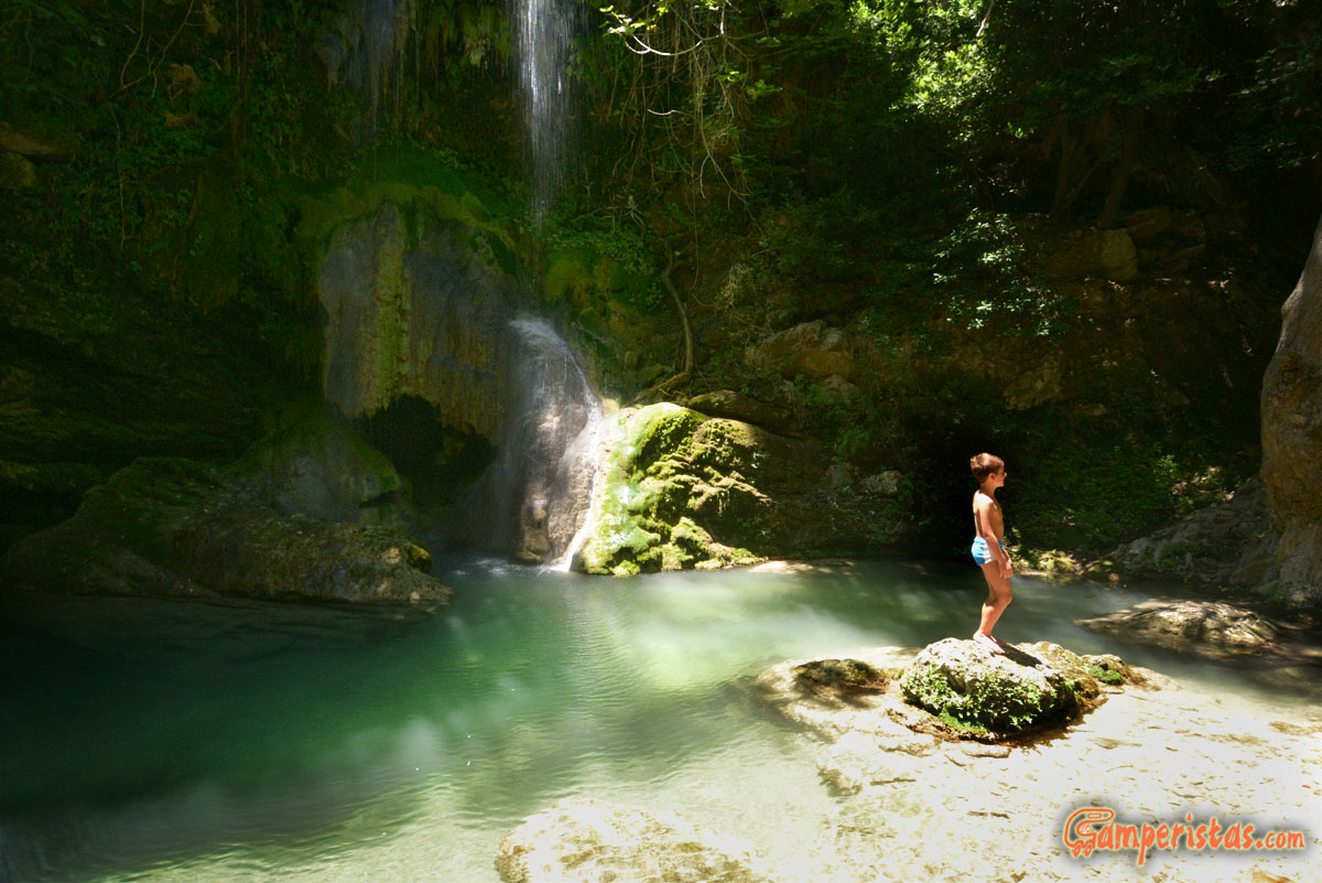
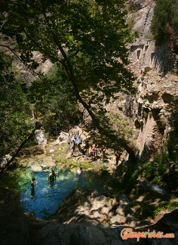
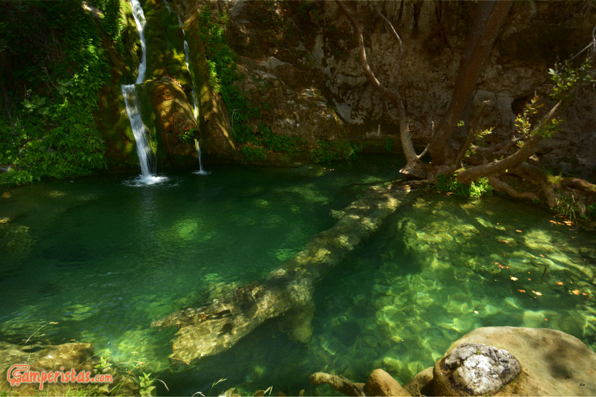
Then we took the road on the left leading to Milopotamos, which means (what a coincidence!) mill on the river. The village is nice, but it’s more a starting point for those who want to visit the waterfalls of Fonissa and the water mills rather than a destination.
There is a parking lot where you can leave your car [N 36.24239, E 22.94588].
The path is well signed and easy to follow It’s about 15 minutes walk to the Falls and an hour further down the trail to the mills. For the mills there is also the possibility to park near the cemetery [N 36.24664, E 22.942161] and shorten a little bit the path, but note that return hike is uphill all the way! You should wear hiking shoes and swimsuit 🙂

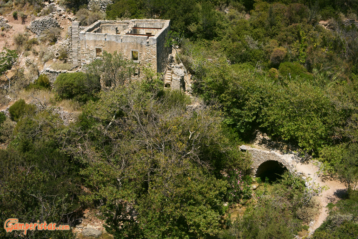

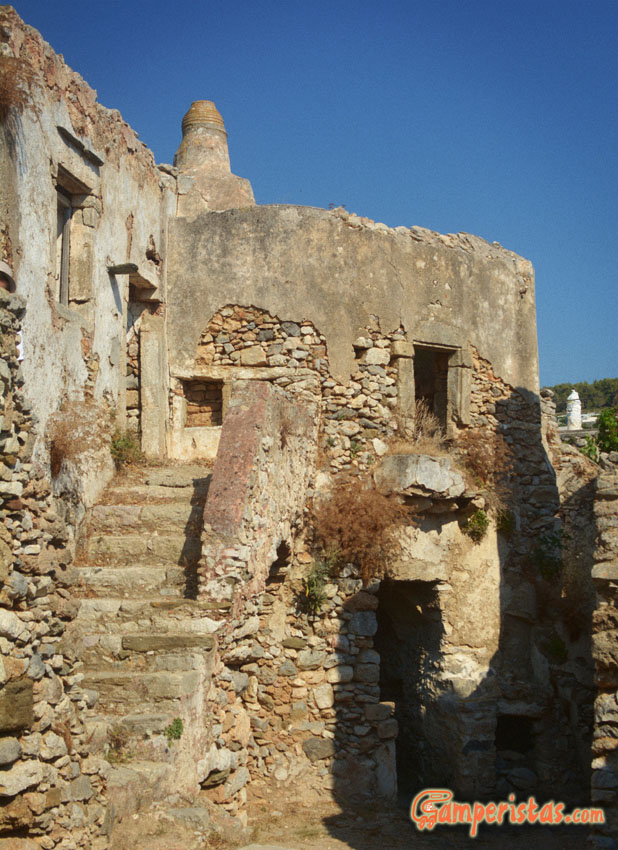
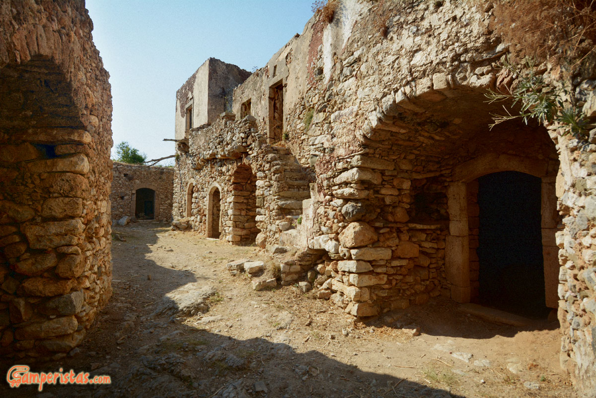
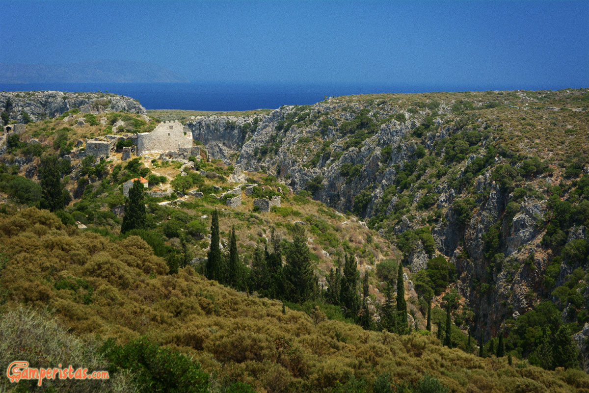
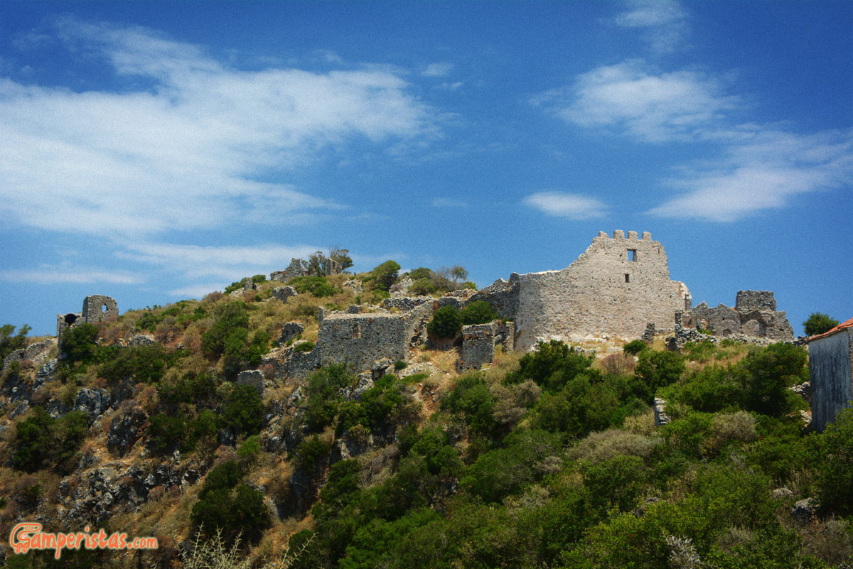
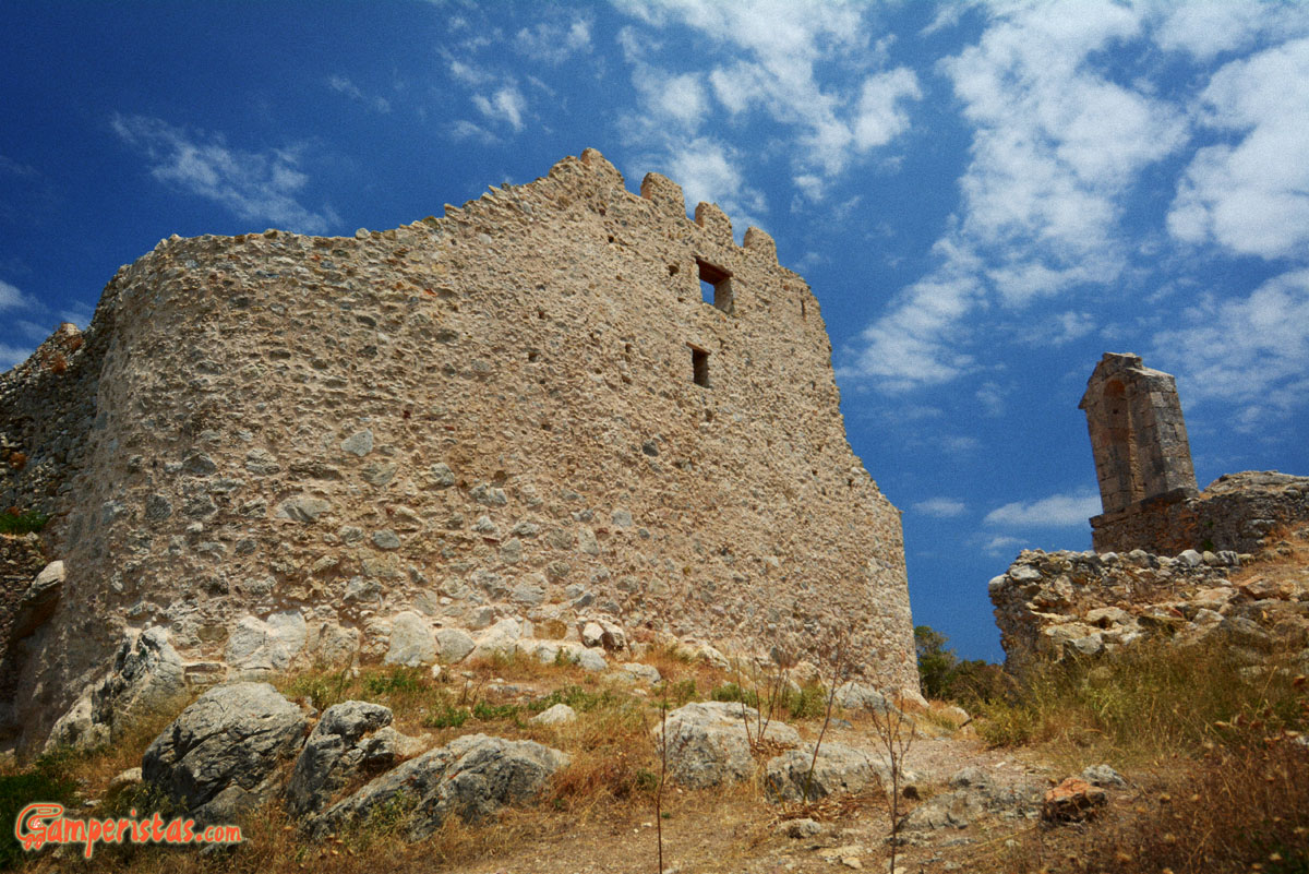
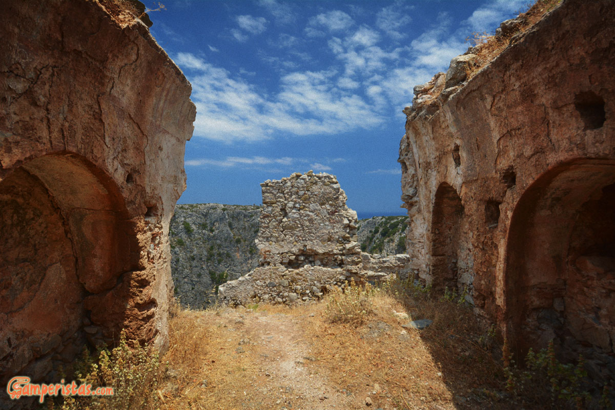
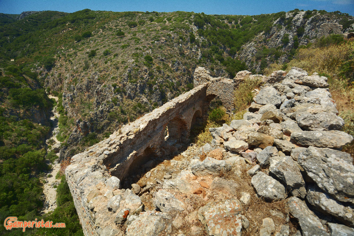
 After Milopotamos, we are heading west to the ruins of the Kato Hora fortress. Built in the mid 1500 by the Venetians, the fortress was inhabited until the postwar period. Now it’s ruined, but it is a nice walk, especially in the late afternoon.

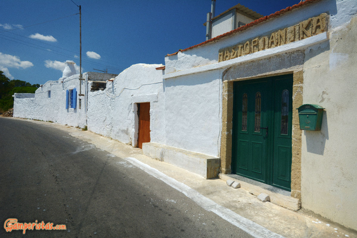

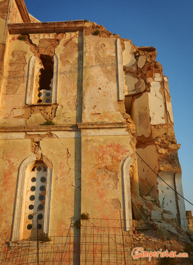
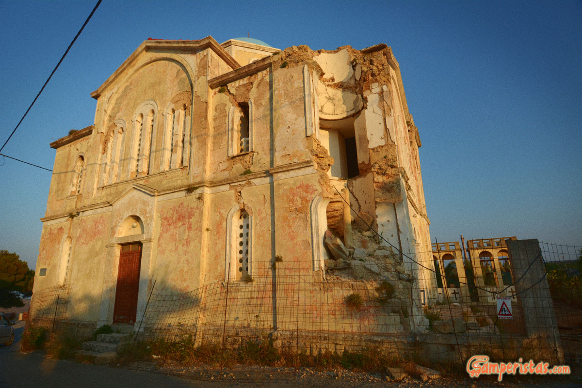
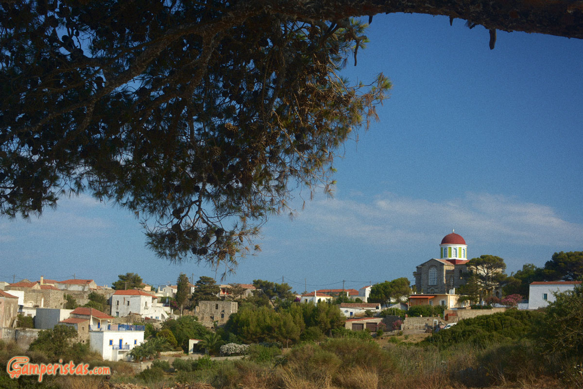 Back on the main road we head for Aroniadika. We see firstly the district of Mastorianika and then the village with the characteristic colored campanile on the junction with the road to Diakofti (the port). Going this way after just a few kilometers, is the village Mitata. (photo below). Here you can still see the scars of the great earthquake of 1903 (7.9 Richter). The church of Agios Ioannis, set in a grotto and situated near the entrance of the village is worth a look too.

Just one kilometer north of the junction of Aroniadika, there is a road on the right that leads to the ruins of the fortress of Paleochora. Unpaved but in good condition, it ends in a open space
[N 36.297211, E 22.995539]; the site is just a few minutes walk away. The medieval town, perched on a cliff overlooking the surrounding gorges, offers impressive views.
 Returning to the main road, still heading north, we find a small road on the left that leads to the lovely monastery of Agios Theodoros.
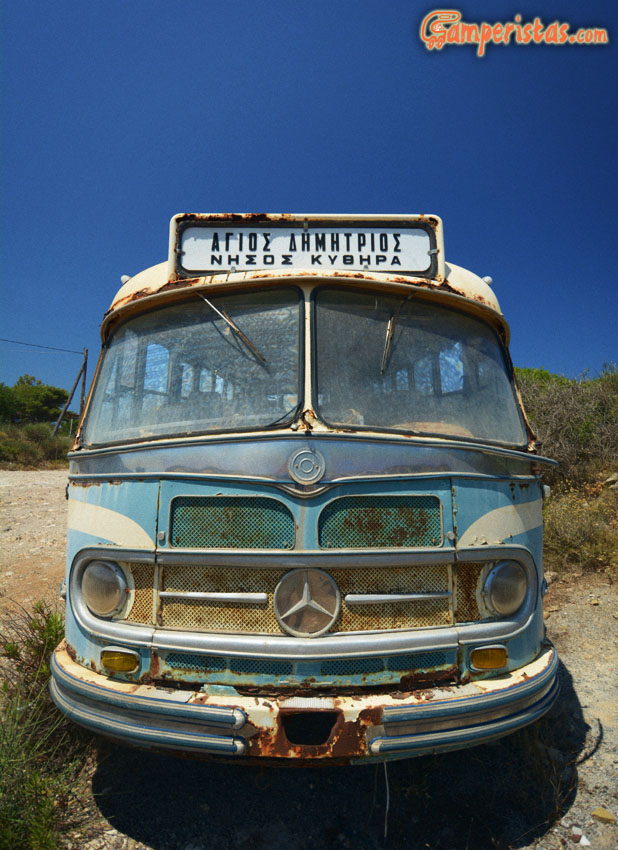
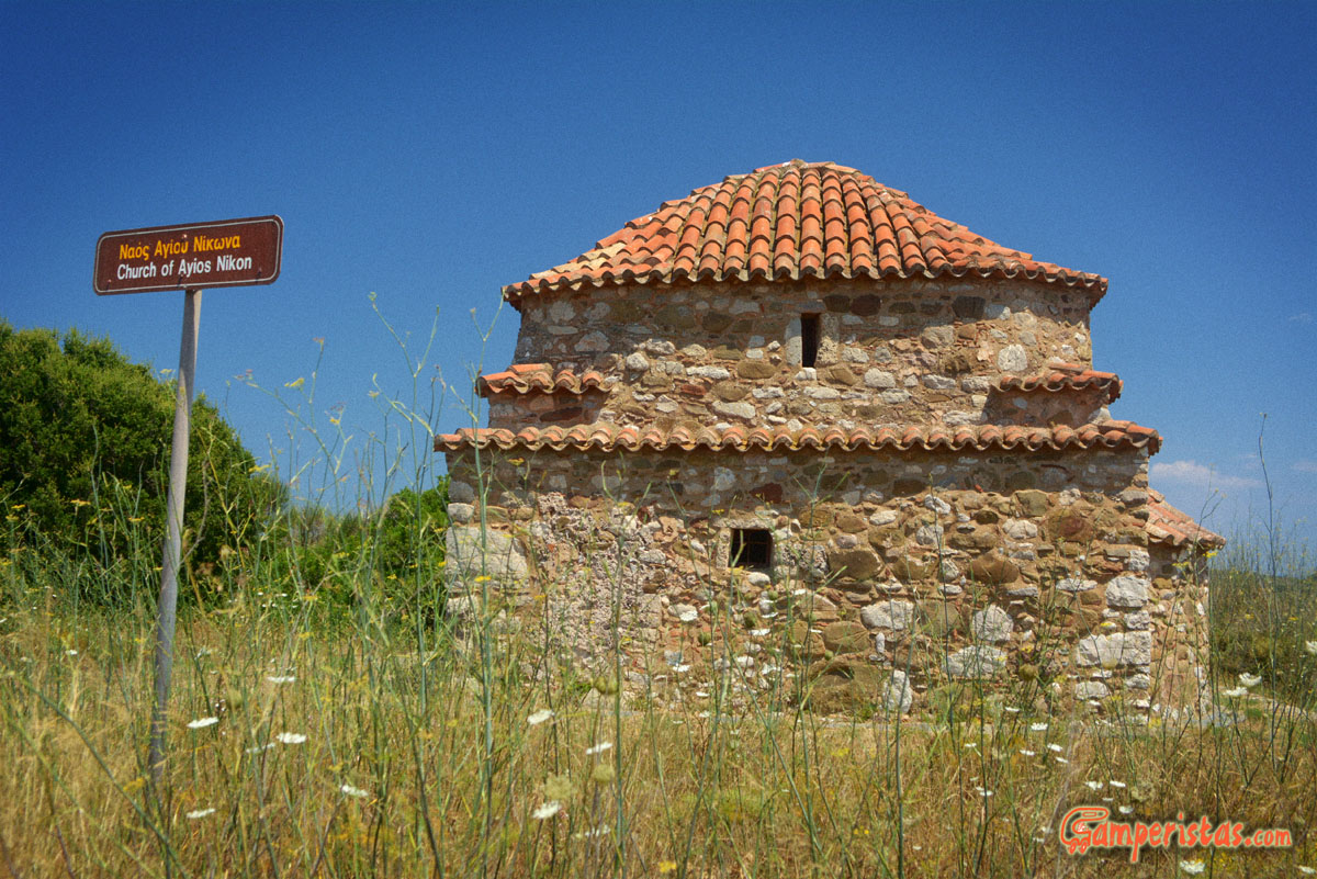 Just a little more to the north, on the right, you’ ll see a dirt road next to a repair shop
[N 36.283642, E 22.966806] where this beautiful bus is parked. This road leads to the byzantine church of St. Nikon, noted saint of photographers, a must stop for all believers !
If you want to pay an homage, leave your RV in the workshop’s lot and walk along this road for about 200 meters.
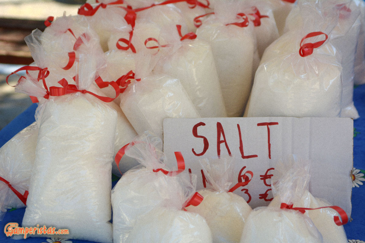
 After another few kilometres you’ll get to Potamos, which means river. There is no more river, just this nice bridge (below) reminds us of its existence. Potamos is the largest town and commercial center of the island. On Saturday morning the central town square becomes a marketplace for handicrafts producers and small-scale farmers. You can taste and buy some good things there.


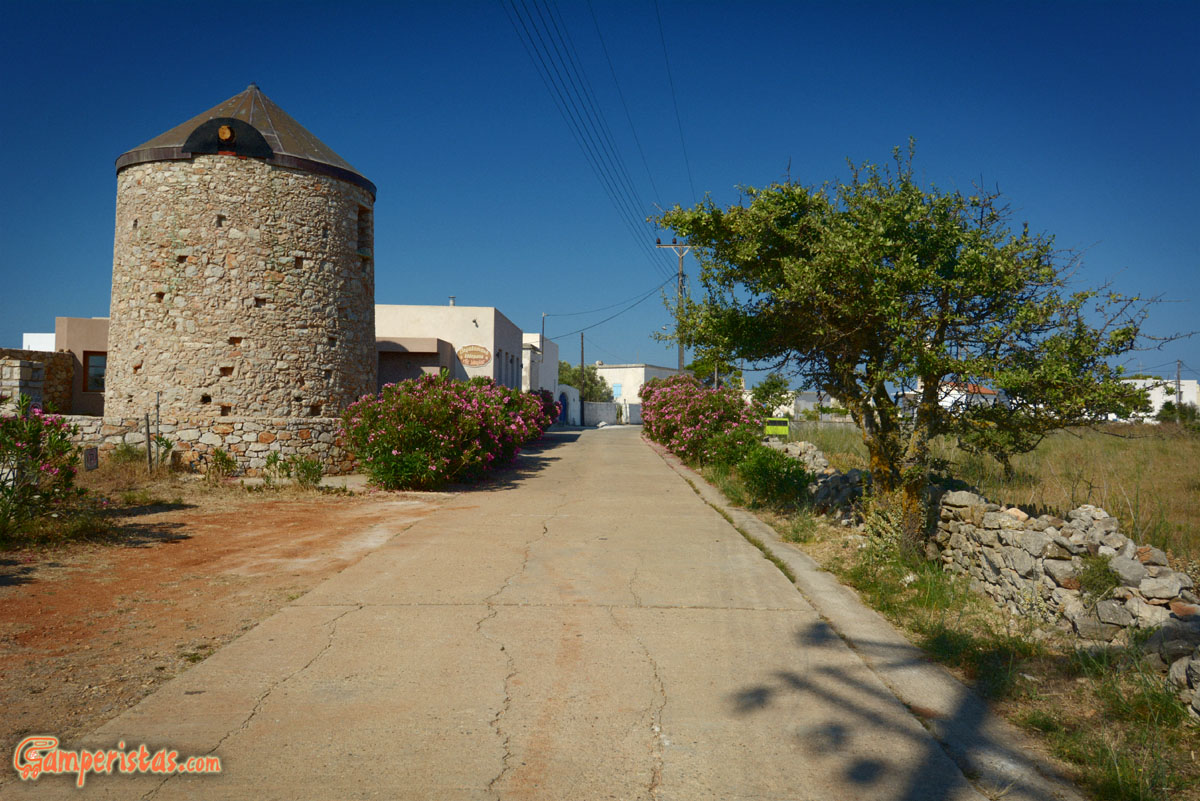
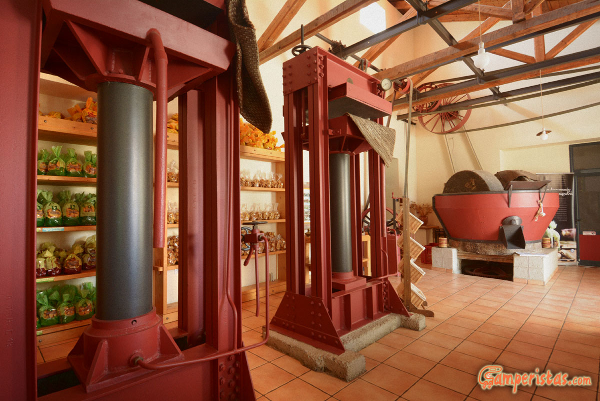
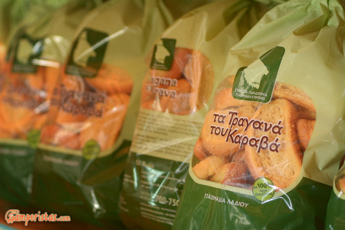
Below: Continuing further up north, you’ll find Karavas, where it’s worth stopping at the bakery to get some Paximadia Kythiron, a traditional type of olive oil rusks. Note that there are four bakeries on the island. This is what we liked the most, followed by that of Potamos. The Karavas bakery is housed in a restored old olive mill
[N 36.345658, E 22.95409]
 To wrap it up: Kythira was a discovery for us that in theory we have seen so many places in Greece. Of course we didn’t see everything and I know for sure that we missed a lot of interesting things , which is great! Now we have a good reason to go back again! 😉
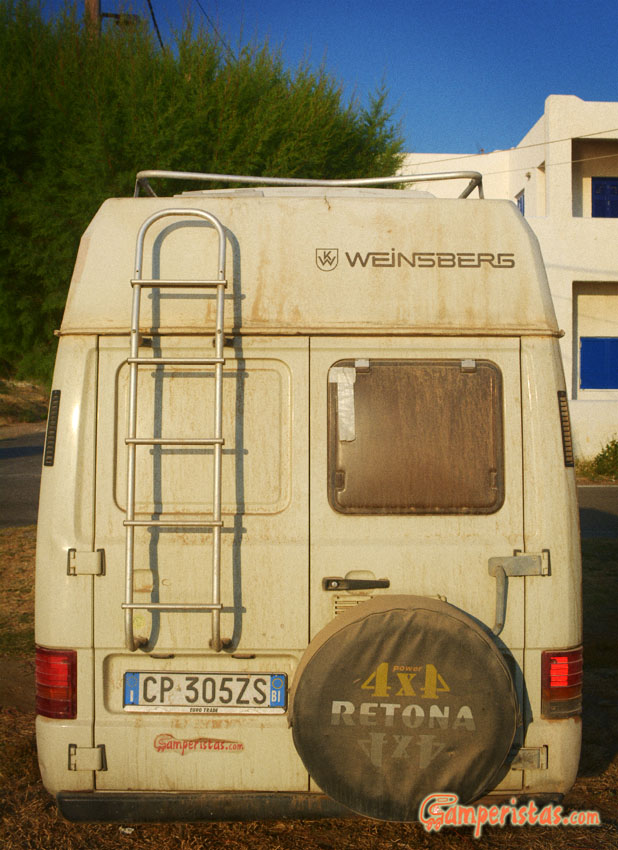
This is our RV after all the dirt roads of Kythira … Just think that we had washed it before we left for this trip!
I want to remind you that Kythira is not an easy destination for RVs, especially those of large size. It’s recommended for experienced drivers only (strange maneuvers, long reverses etc…) Having said this, I think that it is an island waiting to be discovered.
[sam id=”7″]